Improving GPS Position with AGPS
| ✅ Paper Type: Free Essay | ✅ Subject: Technology |
| ✅ Wordcount: 955 words | ✅ Published: 08 Sep 2017 |
5.1.2 A-GPS
A technique which smartphones use to improve GPS precision and speed is called AGPS, or assisted GPS. When a GPS system is first used/turned on, it needs to find clock and orbit data for the satellites it is going to link to. This then results in what is known as TTFF or Time to First Fix which signifies how long it takes for the GPS receiver to acquire its exact location. Assisted GPS circumvents this problematic by using data from the cellular towers on the phone’s network in combination with the phone’s own GPS data to acquire location fix. The time taken to acquire a solution using AGPS is usually much faster as the cellular towers which the phone is communicated data from, are constantly getting GPS data from satellites and calculating the data, this then helps the GPS receiver on the perform tasks such as range capacities and place solutions much faster.
5.1.3. Indoor Positioning QR Codes
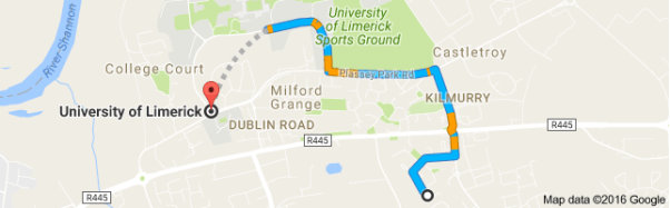
One of the major difficulties to overcome when emerging an app like Plotting UL campus is how to determine a user’s position when they are indoors/under cloud exposure. Although Assisted GPS somewhat alleviates this, GPS triangulation is still unclear at best within buildings so a system must be created to overcome that. QR codes would be an ideal way with which to avoid this problem. Inside every building and floor within the UL Campus there is a noticeboard so Plotting UL Campus could take benefit of this and place a poster with a QR code containing that building/floors GPS co-ordinates? When this is scanned by the smartphone it will open the Plotting UL application and show where you are on the UL Campus map.

6. Navigation Pathfinding
There are a variations of pathfinding algorithms that could be considered for use in the navigation functionality of Campus mapping. These include straightforward point A to point B algorithms such as Dijkstra’s algorithm and more complex “Travelling Salesman” type algorithms which compute the route visiting every point on a graph such as Hamiltonian and Euclidian algorithms. Though, these can be very computationally intensive algorithms that would place a large clang on the smartphone’s CPU.
7. Google maps – API
Google Maps is the most recognised and used mapping context that is currently available. Google launched the Google Maps API in 2005, the API is free of charge for use by designers, provided the application is used in does not charge users, and it does not generate more than 25,000 map views a day, which would be appropriate for this project. As Google also develops the Android platform, Google Maps is proposed to be the most easily implementable mapping framework for this platform. The flaw of Google Maps, from Plotting UL campus perspective is that Google Maps does not display all the individual buildings within UL and this is a necessary module within the application.
7.1 Open street maps
Open Street Maps an open-source plotting outline that is comprised entirely of location data supplied by its users. Meanwhile its formation Open Street Maps has relished increased popularity due to the essential for an unfiltered mapping services that shows all the geographical features of an area as well as a propagation in low-cost GPS-enabled devices.
This detailed mapping of an area, fulfils the need of plotting UL campus to have a mapping basis which displays all the buildings within the university as well as all pathways and roads. The open-source nature of UL mapping also means the API could be deployed to give a lively display of the points-of-interest within the campus that can be tailored to suit specific users, which is one of the main project objectives.
GIS Tools
The varied set of tools which allow the user to create interactive queries, analyse spatial information, edit mapping details, presents the solutions of these operations.
Sample List of tools include:
- Tools for overlay
- Proximity analysis tools
- Surface tools
- Table analysis and management tools
- Tools for selecting and extracting data
11
8. Specification
8.1 Mobile campus map – Hardware and Operating system
|
Equipment |
Smartphone -Lenevo P1ma40 |
|
CPU |
Quad core 1Ghz |
|
Ram |
2.00 GB |
|
Rom |
16.00 GB |
|
OS |
Android Version 5.1 |
|
GPS |
Yes |
|
Frontend |
Keyhole Mark-up Language |
|
Backend |
Java |
|
Database |
MySQL |
12
9. Detailed Action Plan
Detailed action plan for the project is shown below. Apart from this, weekly consultations will be held with the project supervisor and updates will be communicated on a regular basis.

9.1. Discussion
Expended significant time in understanding the mapping layout and tracking of the buildings, the path, navigation, the tools used and the abnormalities which could occur through mobile or the web application. Currently reading the concept of Google maps, the software’s like KML, java, the android OS and the gps used to incorporate the application and working involved in it. I anticipate to come with the successful completion of the project as expected. Arising challenges is to frame the right prototype, implementing with captivating contents and the proper navigation incorporated with relevant GIS tools.
13
9.2. Requirements of facilities and materials.
|
1 |
Complete UL campus map |
|
2 |
Smart phone – Lenovo P1ma40 |
|
3 |
Traffic and Fire Sensors – to detect anomalies |
|
4 |
GPS-Global positioning system |
|
5 |
Wi-Fi |
|
6 |
Router |
|
7 |
Laptop / Desktop |
14
10. References
- IEEE-Design and Implementation of Campus Spatial Information Service Based on Google Maps
- Google Developers. (2016). Google Maps APIs Google Developers. https://developers.google.com/maps.
- Developer.android.com. (2016). Develop Apps | Android Developers. http://developer.android.com/develop/index.html
- Modo Labs. (2016). | Modo Labs. http://www.modolabs.com/products-youll-love/kurogo-mobile-campusfor-higher-education/
- IEEE – Landscape visualization on Google earth
- IEEE – Creation of mobile search system for traffic enquiry
- https://thenewboston.com/videos.php?cat=6
- http://www.androidhive.info/2011/11/android-sqlite-database-tutorial/
- http://www.telerik.com/blogs/how-to-build-an-android-app-that-displays-live-accelerometer-data-using-a-line-chart-control
- http://blog.teamtreehouse.com/beginners-guide-location-android
- https://developer.android.com/studio/install.html
- https://developers.google.com/maps/documentation/android-api/start
Cite This Work
To export a reference to this article please select a referencing stye below:
Related Services
View all


DMCA / Removal Request
If you are the original writer of this essay and no longer wish to have your work published on UKEssays.com then please click the following link to email our support team:
Request essay removal